Predpoklady a príčiny
vypuknutia Karpatsko-duklianskej operácie
Prerequisities and the Causes
of the Outbreak of the Carpatho-Dukla Operation
Opevnenie hranice na obranu karpatských priesmykov
Karpatsko-duklianska operácia bola spolu s Karpatsko-užhorodskou operáciou súčasťou širšie vedenej Východokarpatskej operácie uskutočnenej v dňoch 8. septembra až 28. októbra 1944.
Približne od polovice tohto roku začalo územie vtedajšej Slovenskej republiky zohrávať predovšetkým vo vzťahu k činnosti sovietskych i nemeckých vojsk pôsobiacich na východnom fronte čoraz väčší význam. Osobitné postavenie v tomto smere mali najmä karpatské priesmyky (Dukliansky – 502 m n. m., Laborecký – 686 m n. m. a Lupkovský – 640 m n. m.) nachádzajúce sa v jeho severovýchodnej časti. Tie predstavovali z vojensko-strategického hľadiska najschodnejšiu cestu cez karpatský horský masív v severojužnom smere.
Border fortification to defend the Carpathian passes
The Carpatho-Dukla operation, together with the Carpatho-Uzhhorod operation, was part of the wider East Carpathian operation carried out between September 8 and October 28, 1944.
From about the middle of this year, the territory of the then Slovak Republic began to play a role primarily in relation to the activities of Soviet and German troops operating on the Eastern Front with increasing importance. The Carpathian passes (Dukla Pass – 502 m a.s.l., Laborec Pass – 686 m a.s.l. and Lupkov Pass – 640 m a.s.l.) located in its northeastern part had a special position in this direction. From a military-strategic point of view, they represented the most viable route through the Carpathian mountain massif in a north-south direction.
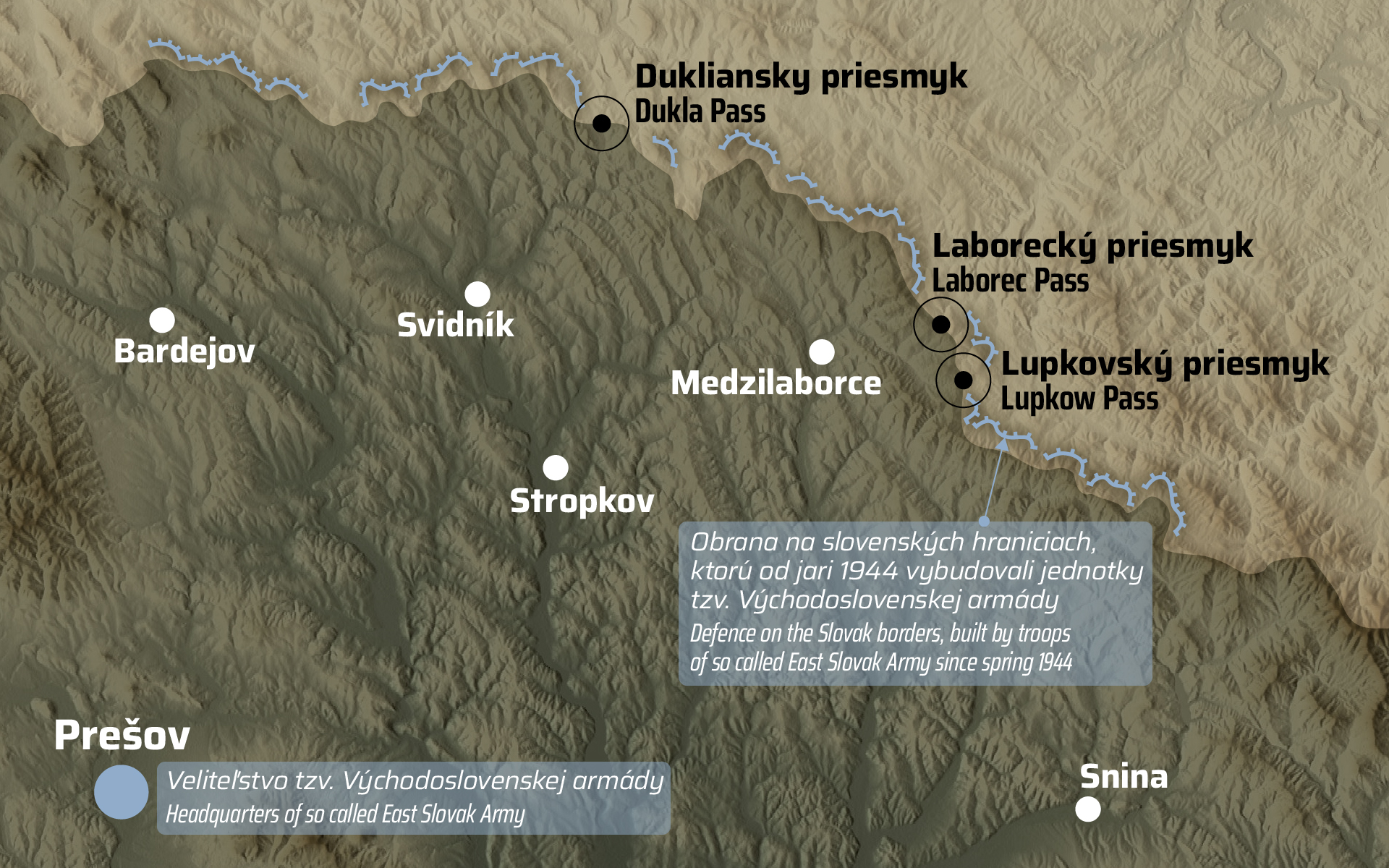
Od jari 1944 boli na území severovýchodného Slovenska dislokované jednotky dvoch peších divízií tvoriacich súčasť novovzniknutej tzv. Východoslovenskej armády s veliteľstvom v Prešove. Na jej čele stál generál Augustín Malár.
Oficiálne bolo primárnou úlohou tohto bojového zoskupenia tvoreného v polovici augusta 1944 približne 30 000 vojakmi a dôstojníkmi vybudovanie pásma súvislých opevnených línií slúžiacich na obranu karpatských priesmykov pred postupujúcou Červenou armádou.
Avšak v skutočnosti sa podľa pôvodného povstaleckého plánu počítalo s tým, že priesmyky obsadené divíziami budú vo vhodnej chvíli uvoľnené a pre postupujúce sovietske vojská tým bude vytvorený voľný prechod na územie Slovenska.
Since the spring of 1944, units of two infantry divisions forming part of the newly formed so-called East Slovak Army with headquarters in Prešov were deployed on the territory of northeastern Slovakia. It was headed by General Augustín Malár.
Officially, the primary task of this battle group, formed in mid-August 1944 by approximately 30,000 soldiers and officers, was the construction of a band of continuous fortified lines serving to defend the Carpathian passes from the advancing Red Army.
However, in reality, according to the original rebel plan, it was calculated that the passes occupied by the divisions would be released at an appropriate moment and free passage to the territory of Slovakia would be created for the advancing Soviet troops.
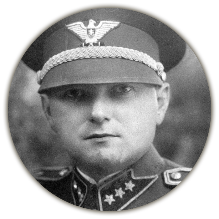
Generál II. triedy Augustín Malár,
veliteľ tzv. Východoslovenskej armády
General II class Augustín Malár,
commander of the so-called
East Slovak Army
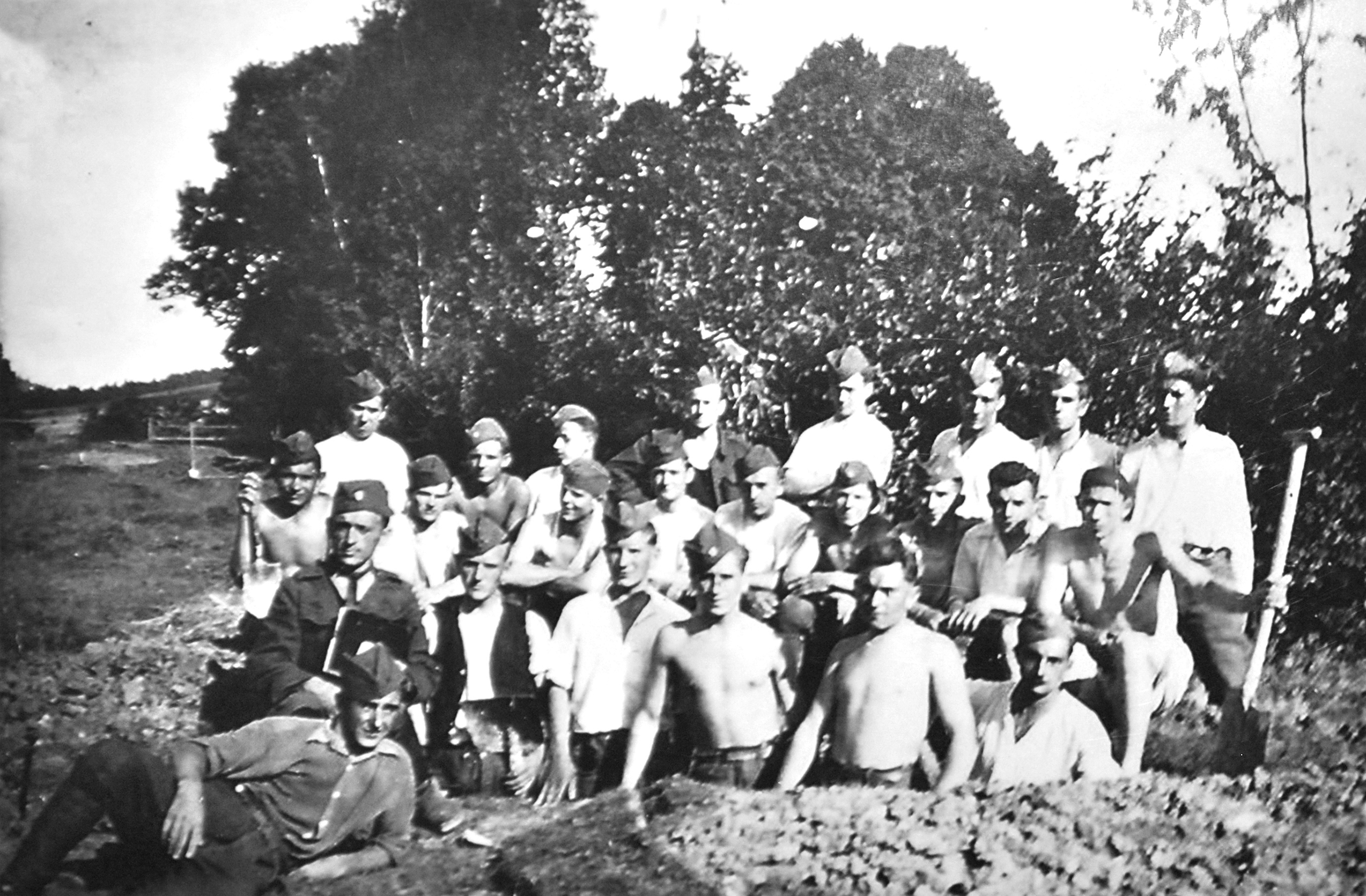
Príslušníci tzv. východoslovenskej armády v priestore Duklianskeho priesmyku pri budovaní obranných pozícii, leto 1944.
Members of the so-called of the East Slovak Army in the area of the Dukla Pass during the construction of defensive positions, summer 1944.
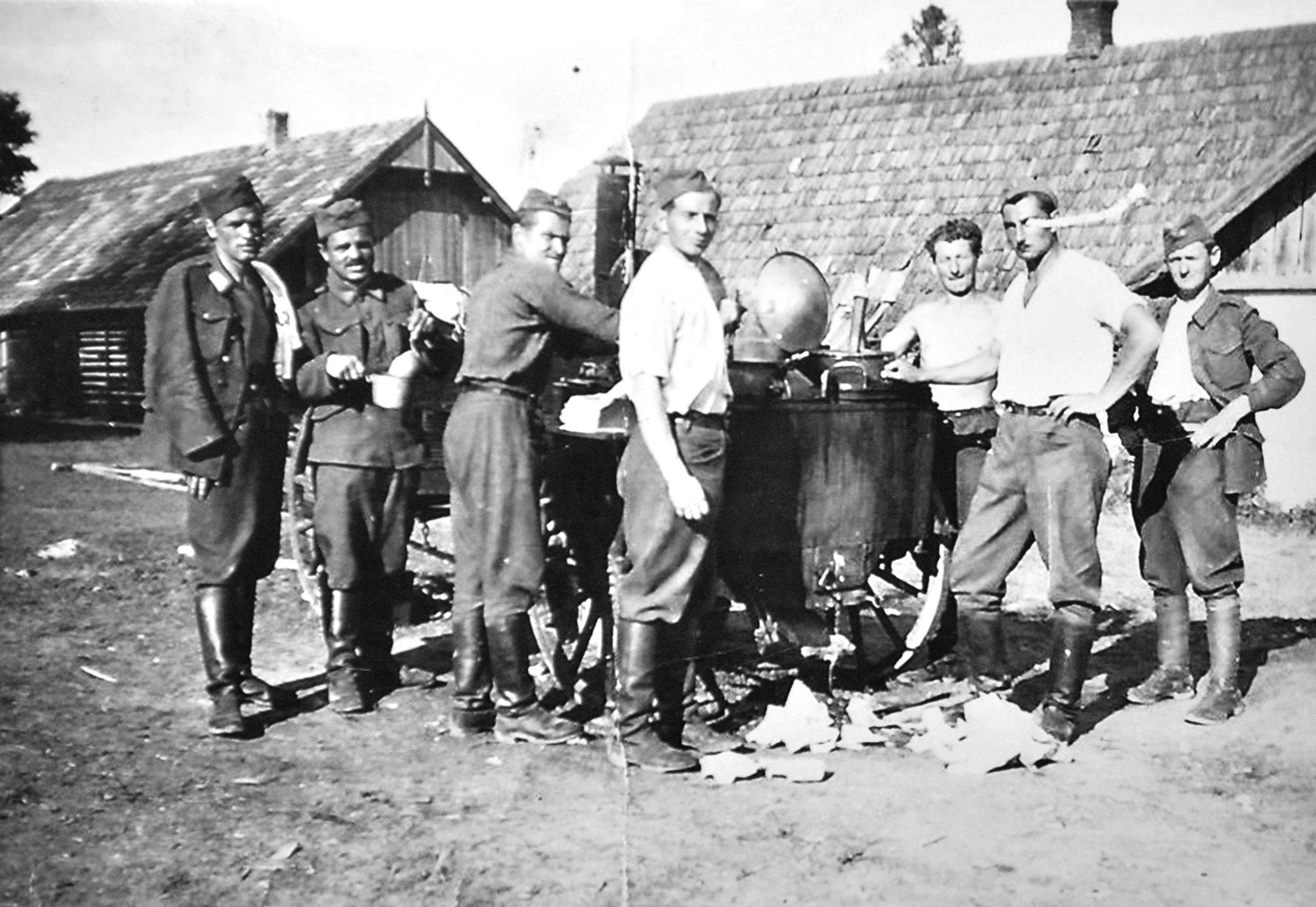
Príslušníci tzv. východoslovenskej armády v priestore Duklianskeho priesmyku pri výdaji stravy v poľnej kuchyni, leto 1944.
Members of the so-called of the East Slovak Army in the area of the Dukla Pass during the distribution of food in the field kitchen, summer 1944.
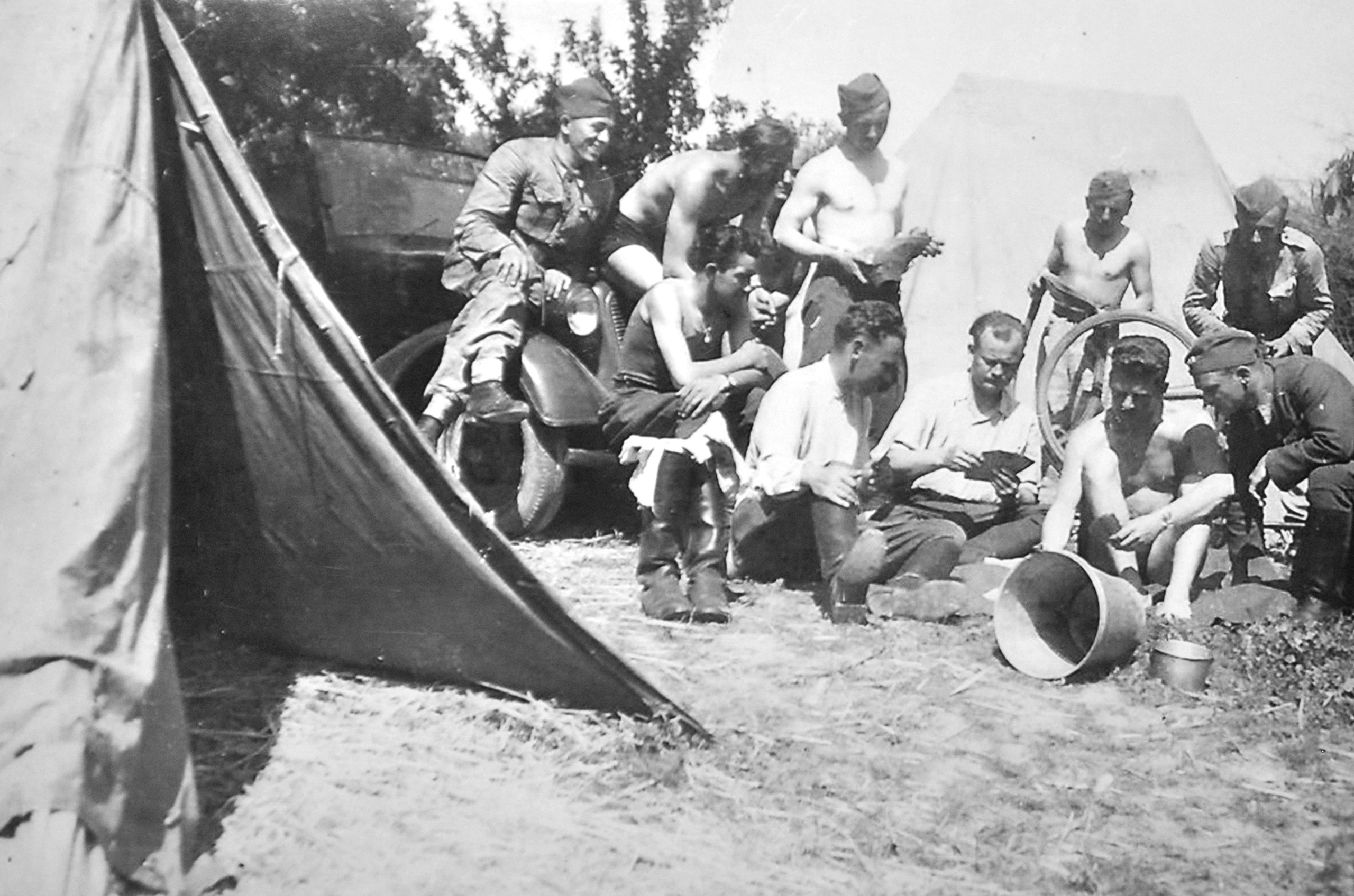
Príslušníci tzv. východoslovenskej armády v priestore Duklianskeho priesmyku vo chvíľach odpočinku, leto 1944.
Members of the so-called East Slovak Army in the area of the Dukla Pass during moments of their rest, summer 1944.
Červená armáda za hranicami
Na konci augusta 1944 sa Červená armáda
priblížila na vzdialenosť asi 40 kilometrov
od severovýchodných hraníc Slovenska.
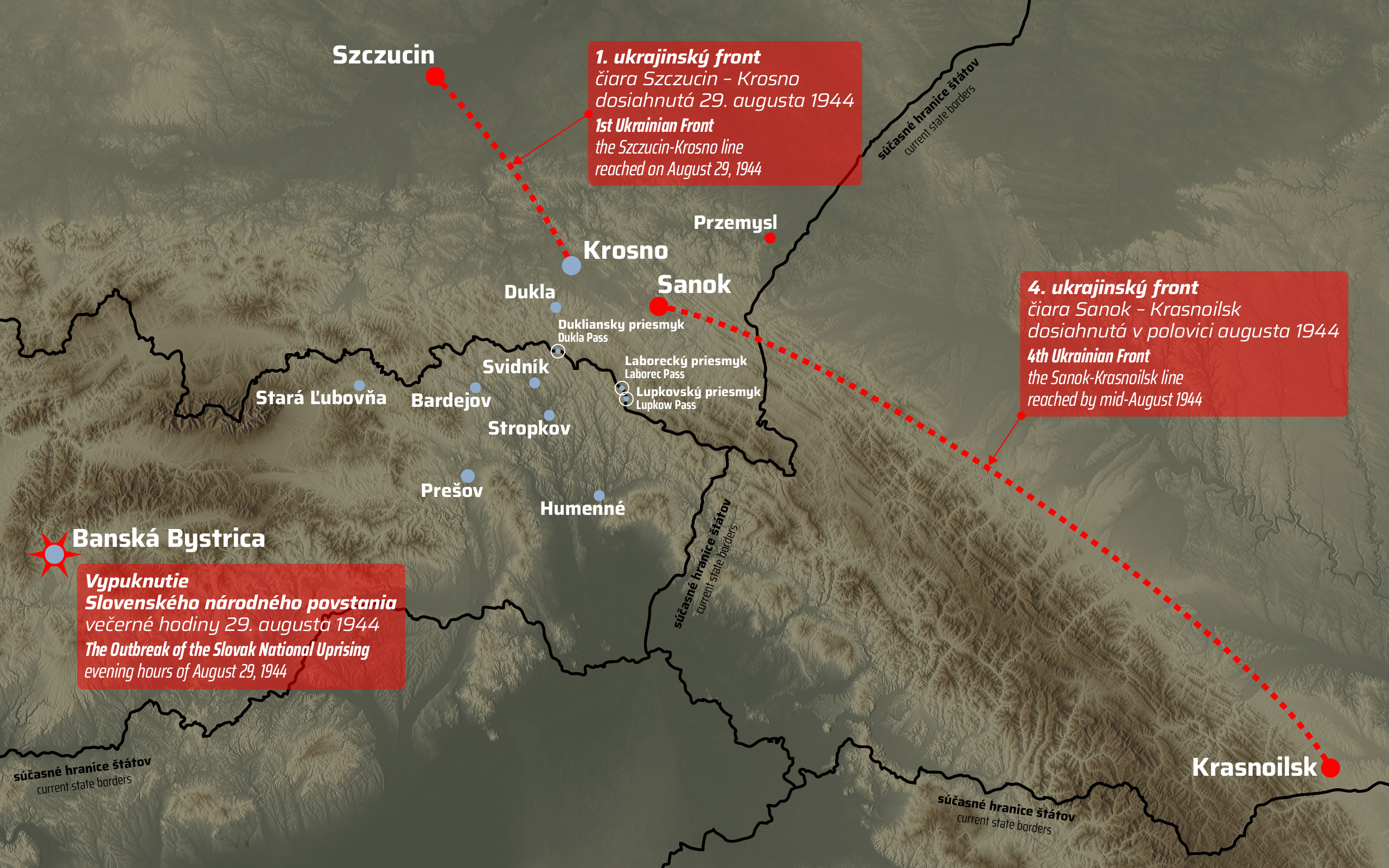
Dňa 29. augusta 1944 bola dosiahnutím čiary Szczucin – Krosno ukončená Ľvovsko-sandomierzská operácia vojsk 1. ukrajinského frontu.
Severne od Karpát pritom paralelne postupovali aj vojská 4. ukrajinského frontu, ktoré do polovice augusta 1944 dosiahli čiaru Sanok – Krasnoilsk.
Red Army across the border
At the end of August 1944, the Red Army
approached to a distance of about 40 kilometers
from northeastern borders of Slovakia.
On August 29, 1944, the Lviv-Sandomierz operation of the troops of the 1st Ukrainian Front was completed by reaching the Szczucin-Krosno line.
North of the Carpathians, the troops of the 4th Ukrainian Front also advanced in parallel, reaching the Sanok-Krasnoilsk line by mid-August 1944.
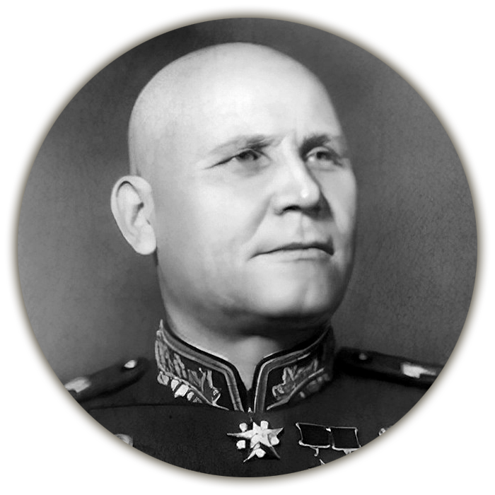
Maršal Ivan Stepanovič Konev,
veliteľ 1. ukrajinského frontu
Marshal Ivan Stepanovich Konev,
commander of the 1st Ukrainian Front
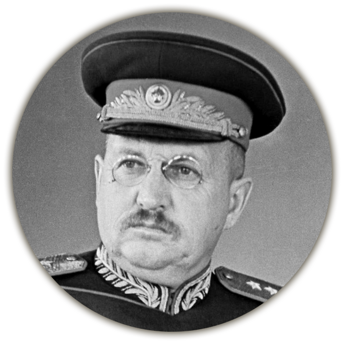
Generálplukovník Ivan Jefimovič Petrov,
veliteľ 4. ukrajinského frontu
Colonel General Ivan Jefimovich Petrov,
commander of the 4th Ukrainian Front
Vypuknutie Slovenského národného povstania
Práve v tejto situácii došlo vo večerných hodinách dňa 29. augusta 1944 k vypuknutiu Slovenského národného povstania (SNP). Jeho centrom sa stala Banská Bystrica.
Táto udalosť následne zásadným spôsobom pozmenila pôvodne plány sovietskeho velenia týkajúce sa obsadenia územia Slovenska obchvatom karpatského horského masívu. Dňa 31. augusta 1944 sa totiž československý veľvyslanec v Moskve, Zdeněk Fierlinger obrátil spolu s náčelníkom československej vojenskej misie v ZSSR, generálom Heliodorom Píkom na sovietsku vládu s oficiálnou žiadosťou o poskytnutie materiálnej a vojenskej pomoci povstaniu.
The Outbreak of Slovak National Uprising
It was in this situation that the Slovak National Uprising (SNU) broke out in the evening hours of August 29, 1944. Banská Bystrica became its center.
This event subsequently fundamentally changed the original plans of the Soviet command regarding the occupation of the territory of Slovakia by bypassing the Carpathian mountain massif. On August 31, 1944, the Czechoslovak ambassador in Moscow, Zdeněk Fierlinger, together with the head of the Czechoslovak military mission in the USSR, General Heliodor Píka, turned to the Soviet government with an official request to provide material and military aid to the uprising.
Plán na pomoc Slovenskému národnému povstaniu
Priamym impulzom na uskutočnenie útočnej operácie vedenej v tomto smere priamo na pomoc SNP bol až návrh veliteľa 1. ukrajinského frontu, maršala Ivana Stepanoviča Koneva predložený dňa 2. septembra 1944 sovietskemu najvyššiemu veleniu.
Plan to help the Slovak National Uprising
The direct impulse to carry out an offensive operation conducted in this direction directly to the aid of the SNU was the proposal of the commander of the 1st Ukrainian Front, Marshal Ivan Stepanovich Konev, submitted to the Soviet Highest Command on September 2, 1944.
Ten bol vypracovaný po Konevovom rozhovore (uskutočnenom dňa 1. septembra 1944) so zástupcom veliteľa tzv. východoslovenskej armády, plukovníkom Viliamom Talským, ktorý mu v ňom oznámil, že v prípade útoku sovietskych vojsk smerom na západ cez priesmyky by obe divízie mohli zaútočiť v smere na východ a spojiť sa s nimi.
It was drawn up after Konev’s interview (held on September 1, 1944) with the deputy commander of the so-called the East Slovak Army, by Colonel Viliam Talský, who informed him in it that in the event of an attack by Soviet troops to the west through the passes, both divisions could attack in the direction to the east and to join them.
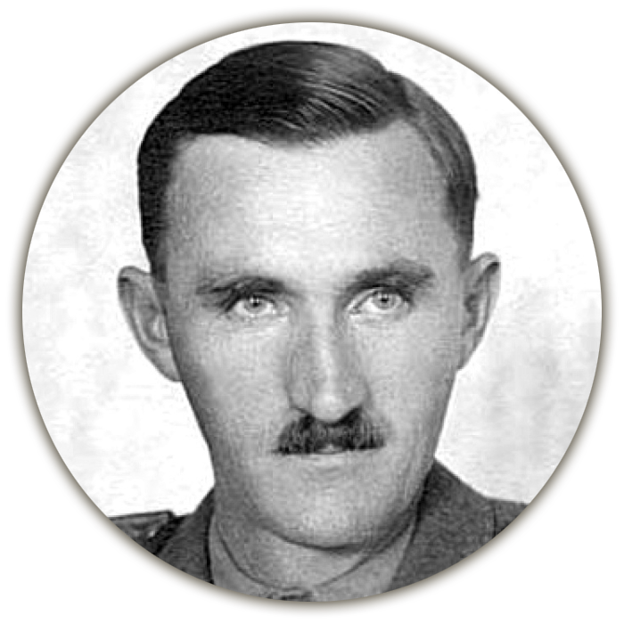
Plukovník generálneho štábu Viliam Talský,
zástupca veliteľa tzv. Východoslovenskej armády
Colonel of the General Staff Viliam Talský,
deputy commander of the so-called East Slovak Army
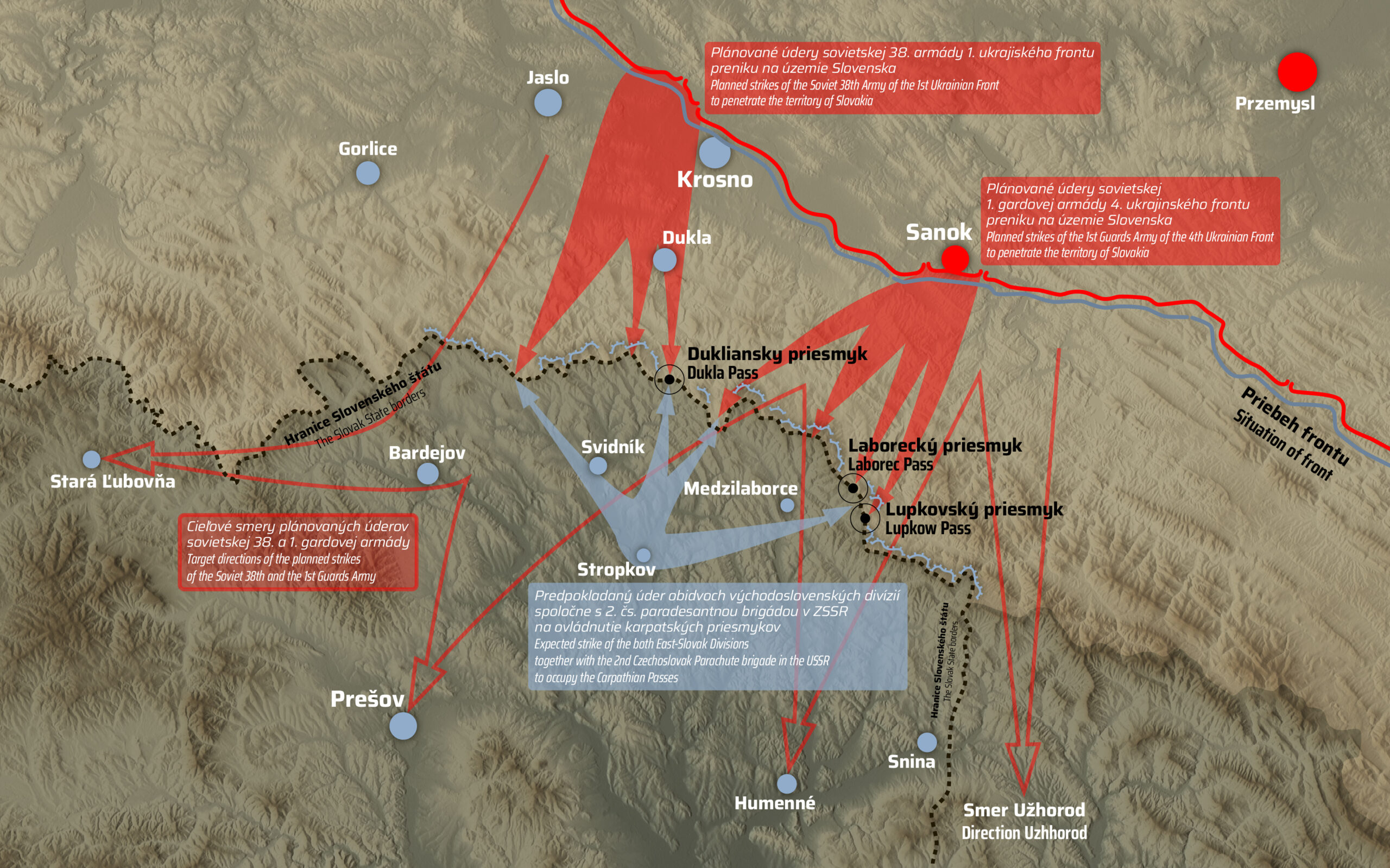
V rámci predloženého Konevovho návrhu sa počítalo so spoločnou útočnou operáciou vojsk ľavého krídla 1. ukrajinského frontu a pravého krídla 4. ukrajinského frontu (veliteľom bol generálplukovník Ivan Jefimovič Petrov) tak, aby sa po prekročení Karpát vstúpilo na slovenské územie v priestore Stropkov – Medzilaborce.
Within the framework of Konev’s proposal, a joint attack was expected by the operation of the troops of the left wing of the 1st Ukrainian Front and the right wing of the 4th Ukrainian Front (the commander was Colonel General Ivan Jefimovich Petrov) so that after crossing the Carpathians they entered Slovak territory in the area of Stropkov - Medzilaborce.
Na základe toho potom ešte v ten istý deň (2. septembra 1944) nariadilo sovietske najvyššie velenie pripraviť a uskutočniť útočnú operáciu cez Karpaty tak, aby sa príslušným vojskám 1. ukrajinského frontu podarilo rýchlym úderom z priestoru Krosno cez Dukliansky priesmyk a príslušným vojskám 4. ukrajinského frontu z priestoru Sanok cez Laborecký i Lupkovský priesmyk preniknúť na územie Slovenska a následne sa spojiť so slovenskými vojskami.
Based on this, on the same day (September 2, 1944), the Soviet Highest Command ordered to prepare and carry out an offensive operation through the Carpathians so that the relevant troops of the 1st Ukrainian Front would succeed in a quick strike from the Krosno area through the Dukla Pass and the relevant troops of the 4th Ukrainian Front from the Sanok area through Laborec and Lupkov passes to penetrate the territory of Slovakia and then connect with Slovak troops.
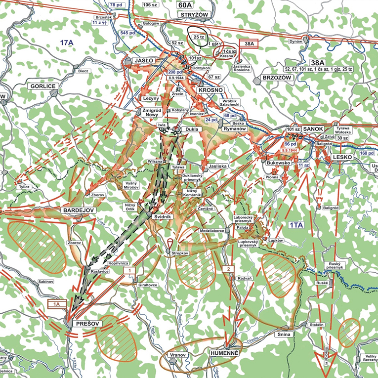
Ihneď na ďalší deň (3. septembra 1944) odoslala vojenská rada 1. ukrajinského frontu sovietskemu najvyššiemu veleniu konkrétny návrh plánu operácie, v ktorom sa okrem iného počítalo jednak s nasadením 1. československého armádneho zboru v ZSSR v zostave 38. armády, a taktiež aj s aktívnou činnosťou tzv. východoslovenských divízií spolu s vysadením paradesantnej brigády v priestore ich činnosti.
The very next day (September 3, 1944), the military council of the 1st Ukrainian Front sent the Soviet Highest Command a concrete draft of the operation plan, which, among other things, provided for the deployment of the 1st Czechoslovak Army Corps in the USSR as part of the 38th Army, as well as with the active activity of the so-called East Slovak divisions together with the landing of the paratrooper brigade in the area of their activity.
POZRI PLÁN OPERÁCIE
SEE PLAN OF THE OPERATION
Navrhovaný plán bol napokon oficiálne schválený dňa 4. septembra 1944. Na prípravu operácie však dostal maršal I. S. Konev vzhľadom na dynamicky sa vyvíjajúcu situáciu len veľmi krátky čas v podobe štyroch až piatich dní. Za normálnych okolností bol na plánovanie takéhoto typu útoku potrebný čas štyroch až šiestich týždňov. Jeho úspech pritom z hľadiska stanoveného cieľa závisel predovšetkým na momente prekvapenia a vysokom tempe úderu. Práve preto sa v pláne počítalo s tým, že už počas prvých troch dní budú dosiahnuté hranice Slovenska na hlavnom karpatskom hrebeni a na piaty deň potom čiara Stará Ľubovňa – Sabinov – Prešov.
The proposed plan was finally officially approved on September 4, 1944. However, due to the dynamically developing situation, Marshal I. S. Konev was given only a very short time of four to five days to prepare the operation. Under normal circumstances, four to six weeks were needed to plan this type of attack. His success, from the point of view of the set goal, depended above all on the moment of surprise and the high tempo of the strike. That is why the plan counted on the fact that during the first three days the borders of Slovakia will be reached on the main Carpathian ridge and on the fifth day the line Stará Ľubovňa - Sabinov - Prešov will be reached.
Obranné opatrenia nemeckého velenia
S možným útokom Červenej armády cez Karpaty však nemecké velenie počítalo už v tretej dekáde augusta 1944. Po vypuknutí povstania si jeho predstavitelia uvedomovali, že prelomením Karpát v priestore severovýchodného Slovenska by bezprostredne hrozil vpád sovietskych vojsk do tylu zoskupení brániacich sa proti 2. a 4. ukrajinskému frontu. Preto sa z ich strany okamžite začalo s prípravou adekvátnych opatrení.
Defensive measures of the German command
However, the German command was already counting on a possible attack of the Red Army through the Carpathians in the third decade of August 1944. After the outbreak of the uprising, its representatives were aware that breaking through the Carpathians in the area of northeastern Slovakia would immediately threaten the incursion of Soviet troops into the rear of the groups defending against the 2nd and 4th Ukrainian front. That is why they immediately started preparing adequate measures.
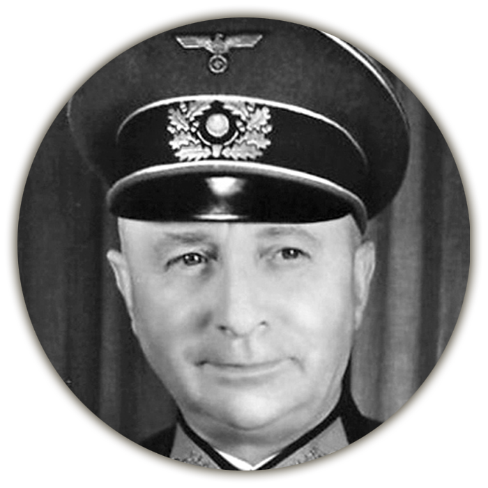
Ak 1. kráľovská armáda z akéhokoľvek dôvodu celkom alebo čiastočne prestane brániť Karpaty, je úlohou armádnej skupiny Heinrici naďalej zabezpečiť spojenie so skupinou armád Južná Ukrajina.“
Generálplukovník Josef Harpe, veliteľ skupiny armád Severná Ukrajina, ďalekopis na štáb armádnej skupiny Heinrici zo dňa 24. augusta 1944.
“If, for any reason, the 1st Royal Army ceases to defend the Carpathians in whole or in part, the task of Army Group Heinrici is to continue to ensure the connection with Army Group South Ukraine.”
Colonel General Josef Harpe, commander of Army Group North Ukraine, telegraph to the headquarters of Army Group Heinrici dated August 24, 1944.
Jedným z opatrení bolo aj odzbrojenie a internovanie príslušníkov obidvoch tzv. východoslovenských divízií počas operácie s názvom Kartoffelernte mit Prämie (Zber zemiakov s prémiou) uskutočnenej v dňoch 31. augusta až 7. septembra 1944. Týmto krokom sa Nemcom podarilo zabrániť ich možnému spojeniu s protistojacimi sovietskymi a československými silami.
One of them was the disarmament and internment of members of both so-called East Slovak divisions during the operation called Kartoffelernte mit Prämie (Harvesting of potatoes with a premium) carried out from August 31 to September 7, 1944. With this step, the Germans managed to prevent their possible connection with the opposing Soviet and Czechoslovak forces.
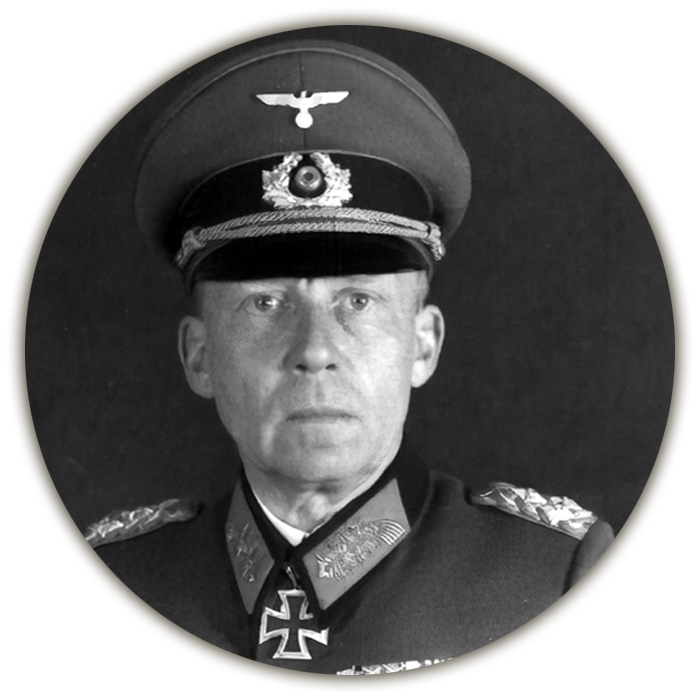
„... odzbrojených vojakov treba internovať, sústrediť a strážiť XXIV. tankovým zborom v jeho vlastnom operačnom pásme severne od slovenských hraníc genmjr. J. Rintelenom v Košiciach v dohode s tamojším miestnym veliteľstvom tylového armádneho priestoru v Michalovciach... XXIV. tankový a 11. armádny zbor zablokujú na svojich úsekoch všetky cesty severne od južných hraníc generálneho gubernátu vedúce na severovýchod a sever, a tým zabránia úteku slovenských jednotiek a ich následnému prechodu k boľševikom.“
Generálplukovník Gotthard Heinrici, veliteľ armádnej skupiny Heinrici, bojová porada na veliteľskom štábe skupiny v Užhorode dňa 25. augusta 1944 (o štyri dni neskôr bol štáb presťahovaný do Sobraniec).
“... disarmed soldiers must be interned, concentrated and guarded by the XXIV tank corp in its own operational zone north of the Slovak border, by Maj. Gen. J. Rintelen in Košice. In an agreement with the local headquarters of the rear army area in Michalovce... XXIV the tank and 11th army corp will block in their sections all roads north of the southern borders of the general governorate leading to the northeast and north, thereby preventing the escape of Slovak troops and their subsequent transition to the Bolsheviks.”
Colonel General Gotthard Heinrici, commander of Army Group Heinrici, a combat meeting at the group’s command staff in Uzhhorod on August 25, 1944 (four days later the staff was moved to Sobrance)..
Rozkaz na uskutočnenie Karpatsko-duklianskej operácie
O krokoch nemeckého velenia boli medzitým dostatočne informovaný aj sovietski velitelia. Na rozdiel od návrhu plánu operácie sa už v následnom rozkaze o jej uskutočnení ústretový úder oboch divízií vôbec nespomínal.
Začiatok operácie bol stanovený na 8. september 1944. V nasledujúcich piatich dňoch mali postupujúce vojská prekonať sedem pomerne členitých karpatských hrebeňov vzájomne oddelených údoliami s početnými vodnými tokmi a málo rozvinutou cestnou sieťou.
Order to execution of the Carpatho-Dukla operation
In the meantime, the Soviet commanders were also sufficiently informed about the actions of the German command. Unlike the draft plan of the operation, the subsequent order for its implementation did not mention the counter strike of the two divisions at all.
The beginning of the operation was set for September 8, 1944. In the following five days, the advancing troops were to overcome seven rather fragmented Carpathian ridges, separated from each other by valleys with numerous watercourses and a poorly developed road network.
„Najdôležitejšia bude rýchlosť. Rýchle prevedenie prielomu a rýchle rozšírenie úspechu. Je nutné preniknúť do Karpát tak rýchlo, aby nepriateľ nestačil presunúť zálohy do bojov o karpatské predhorie... Času mnoho nemáte. Musíte sa poponáhľať, aby vaše jednotky boli v stanovenú dobu v pohotovosti. A pamätajte si: buď Karpaty prejdeme, alebo na nich padneme!“
Maršal Ivan Stepanovič Konev, veliteľ 1. ukrajinského frontu, bojová porada na štábe frontu v Ľvove pred začiatkom Karpatsko-duklianskej operácie dňa 7. septembra 1944.
“The most important thing will be the speed, fast implementation of breakthrough and rapid expansion of success. It is necessary to penetrate the Carpathians so quickly that the enemy does not have enough time to move reserves to the battles for the Carpathian foothills... You do not have much time. You have to hurry so that your units are ready in the specified time. And remember: either we cross the Carpathians or we fall on them!”
Marshal Ivan Stepanovich Konev, commander of the 1st Ukrainian Front, a battle meeting at the front headquarters in Lviv before the start of the Carpatho-Dukla operation on September 7, 1944.
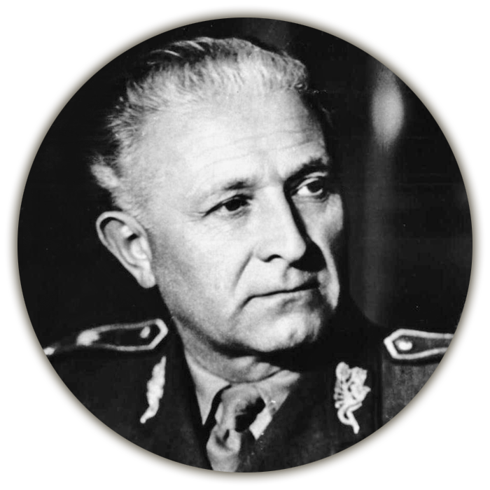
„Vpíjam sa očami do mapy, do spleti šípok a čiar, znázorňujúcich postup a miesta našich budúcich úderov. Sovietske velenie vybralo najvýhodnejší smer, najdostupnejšiu časť Karpát. V tých miestach, kade budeme útočiť, nepresahuje karpatský masív nadmorskú výšku 700 metrov. Konfigurácia terénu nie je pre nás však nijako priaznivá. Šesť, sedem horských priečnych hrebeňov, oddelených od seba úzkymi dolinami so slabo rozvinutou sieťou komunikácií a s početnými vodnými tokmi, bude nepriateľovi poskytovať výhodné podmienky pre obranu. A nám – útočiacim – sťažovať manévre zvlášť tankových a delostreleckých síl...na úseku prielomu sa počíta s viac ako stopäťdesiatimi hlavňami na kilometer frontu.“
Brigádny generál Ludvík Svoboda, veliteľ 1. československej brigády, štáb veliteľa 1. ukrajinského frontu v Ľvove počas porady dňa 7. septembra 1944.
“I fix my eyes on the map, on the tangle of arrows and lines, showing the progress and the places of our future strikes. The Soviet command chose the most advantageous direction, the most accessible part of the Carpathians. In the places where we will attack, the Carpathian massif does not exceed an altitude of 700 meters. However, the configuration of the terrain is not favorable for us. Six or seven transverse mountain ridges, separated from each other by narrow valleys with a poorly developed network of communications and numerous watercourses, will provide the enemy with favorable conditions for defense. And for us - the attackers - to make it difficult for the maneuvers of especially tank and artillery forces...in the section of the breakthrough, more than one hundred and fifty barrels are calculated per one kilometer of the front.”
Brigadier General Ludvík Svoboda, commander of the 1st Czechoslovak Brigade, staff of the commander of the 1st Ukrainian Front in Lviv during a meeting on September 7, 1944.
Schéma presunu 1. čs. armádneho zboru v ZSSR
do priestoru Karpatsko-duklianskej operácie
Scheme of the transfer of the 1st Czechoslovak Army Corps in the USSR to the area of Carpatho-Dukla Operation

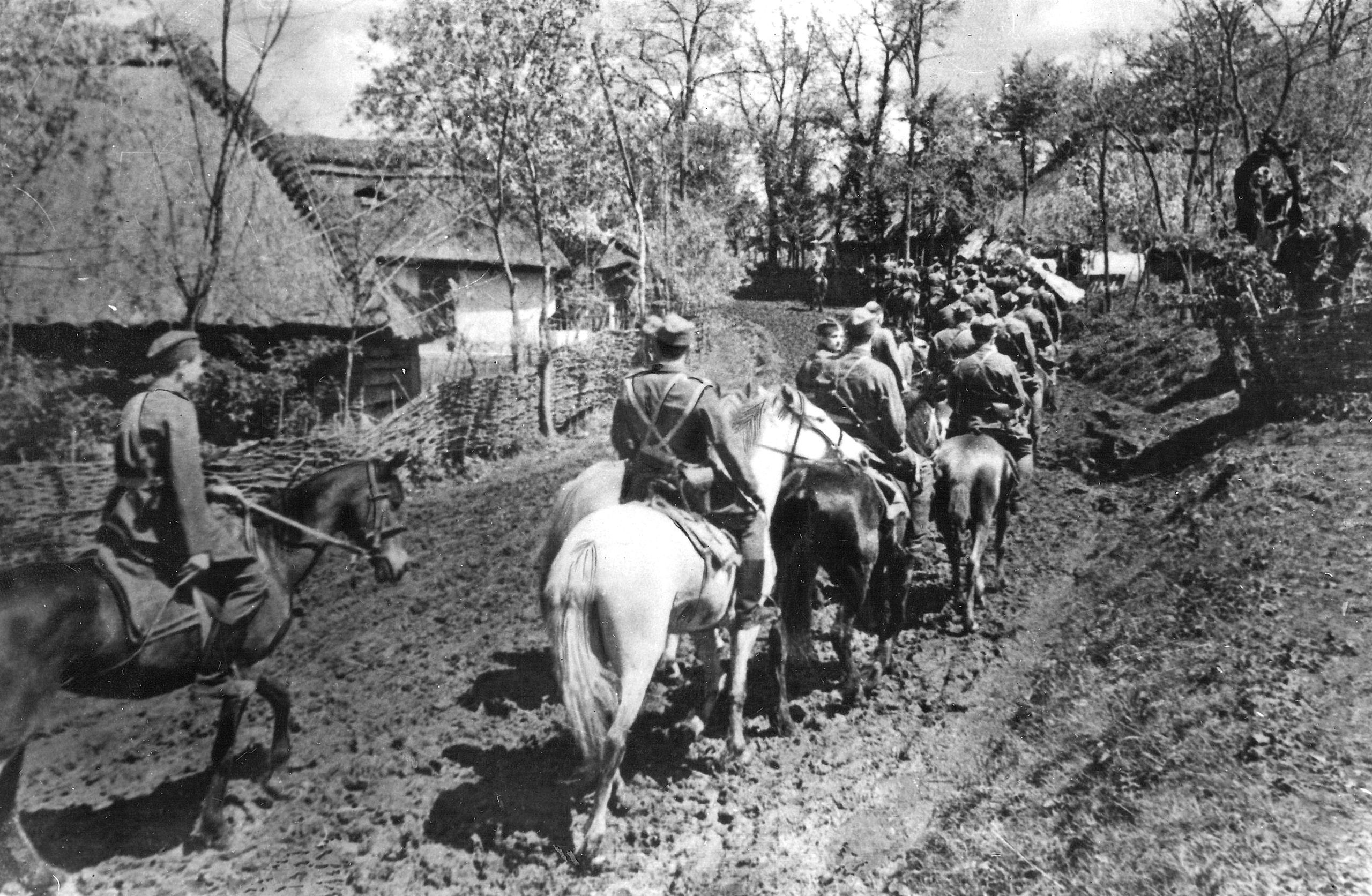
Československá jazdecká jednotka prechádza jednou z poľských dedín v predhorí Karpát.
A Czechoslovak cavalry unit passes one of the Polish villages in the Carpathian foothills.
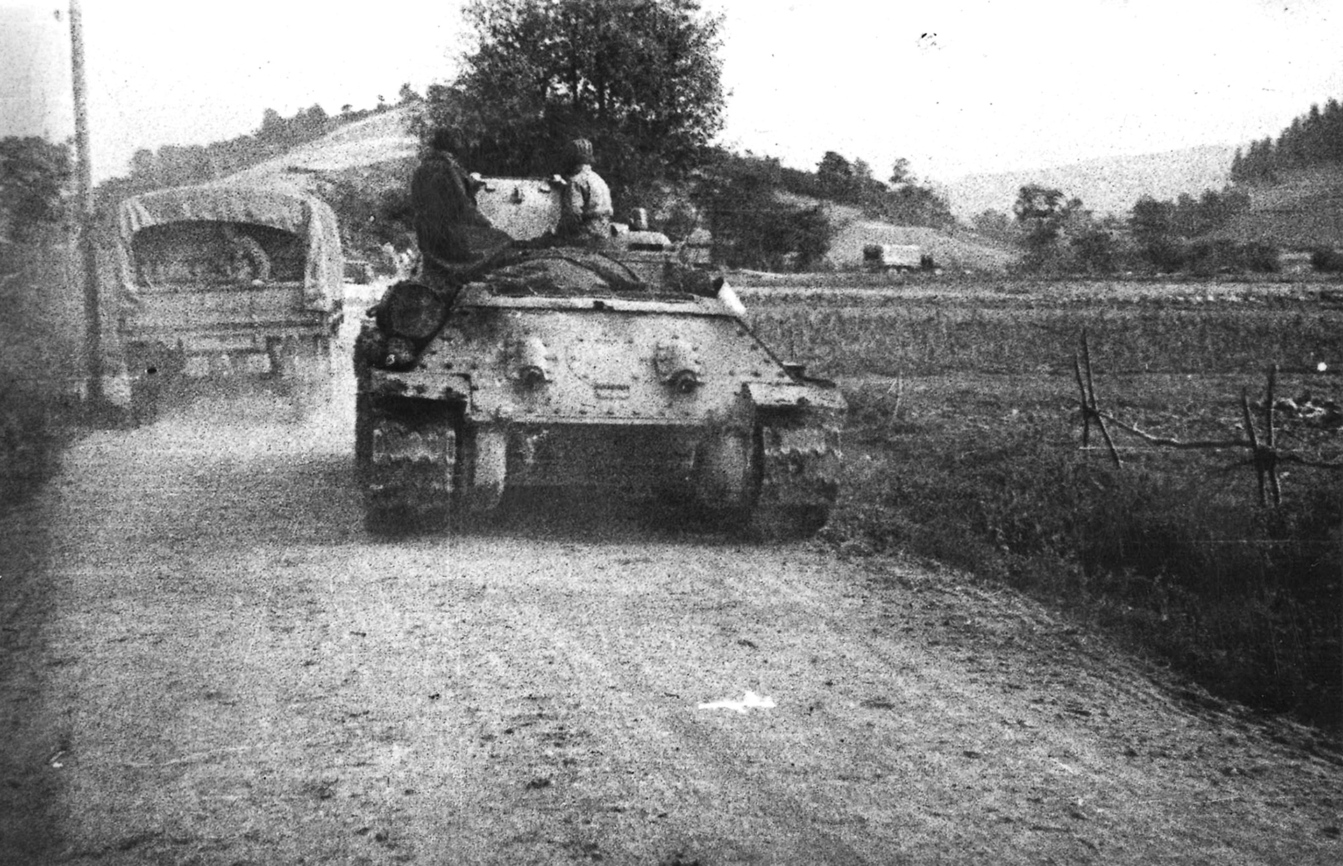
Československí tankisti v predhorí Karpát.
Czechoslovak tankmen in the Carpathian foothills.